
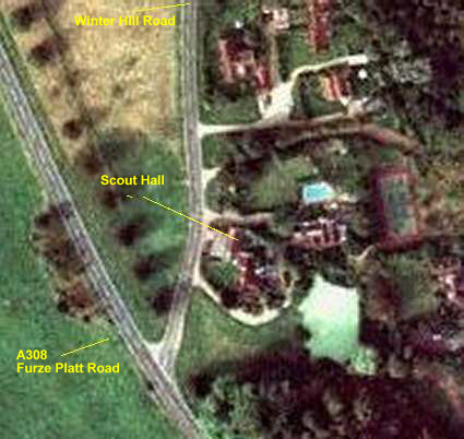
Below is an Aerial Photo, 1882 OS Map & Current OS Map
showing PG Scout Hall
Aerial Photo of Scout Hall
1882 OS Map
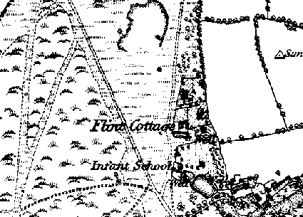
Scout Hall is marked as Infant School
Current OS Map
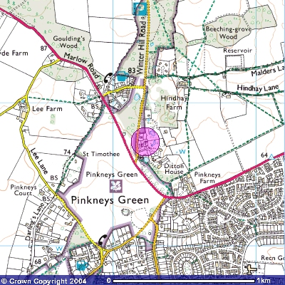
Scout Hall is in the marked area
Image produced from the Ordnance Survey
Get-a-map service. Image reproduced with kind permission of Ordnance Survey and Ordnance Survey of Northern Ireland.
Click Here for Street Map of Scout Hall
Grid Reference - SU862826
Lat - N51:32:11 ( 51.536433 )
Long - W0:45:30 ( -0.758426 )
Post Code - SL6 6NS